About Bicycles Online > Bicycle Touring and Trails > Inverness Trail
The Inverness Bike Trail, Road Trip
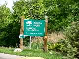
 Starting at South Park. |
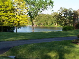
 Lake Inverness, along Clover Drive. |
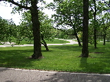
 The northern end of the road trip, on Blackburn. |
The Inverness Trail (Illinois - 11.2m (plus)) - OK, there is really no "official" "Inverness Trail" or "Inverness Bike Trail", but there are some great biking roads in Inverness if you know where to go and how to get there. I am calling this the "Inverness Trail" for consistency with the other trail pages on this site and also since, at the time of this writing, I have found no other references on the internet to Inverness bike trails or Inverness biking road trips.
You will find a number of biking trails within the Inverness, Illinois area (Deer Grove, for example), and you do see cyclists in various parts of Inverness, but it can be very difficult to find the connecting roads, places to cross the highways and the best areas to ride.
Well, I live within a very short ride to Inverness, have explored most of Inverness pretty extensively and have mapped out what I believe the be one of the best bike routes in all of Inverness. This is, of course, not the only nice riding area in Inverness, but I believe this route will give you the most miles, potential miles, scenic areas and help you to find the connecting roads and crossings.
This article includes a detailed map of this particular Inverness road trip, which is East of Ela Road, West of Roselle road, North of Algonquin and South of Dundee (68) and Northwest Highway (14). This is the eastern part of Inverness. I am also including quite a few photos of the road trip, with photos of some of the houses and scenic sites along the road trip to give you a "feel' for what kind of ride this is.
Bike Trail Information
Distance: 11.2 miles. This is if you simply go from South Park, to the northern most section of Inverness (between Ela and Roselle) and back to South Park. You can also take a number of side trips, explore a little or loop through your favorite areas more than once to extend the trip to over 20 miles pretty easily (I usually stretch this trip to 18 miles or more).
Location: East of Ela Road, West of Roselle road, North of Algonquin and South of Dundee (68) and Northwest Highway (14). You can usually park at South Park, in Inverness (go to Thompsons Way via Clover Drive (accessible via Palatine Road or Roselle Road).
If you are not able to park at South Park (usually you can, but there could be soccer games at the park), you can try North Park (on the map below) or even Harper College* (*see directions from Harper below)
Surface: Paved, winding, roads with very little traffic. This trip is fairly flat but a little bit hilly (for Illinois, anyway) in some areas.
Additional Information:
As I mentioned above, traffic is very light in this part on Inverness. It is amazing how little traffic there is in this area considering it's relative location. I think this is largely due to the fact that the roads are residential only and wind around quite a bit with very few outlets to the major highways.
Maps:
Here is a color coded map of the Inverness bike trail, road trip that I have put together. The main trail, from south to north (and back) is in red, with some nice side trips in green... Most of the other local roads are in yellow for your references.
Inverness Bike Trail, Road Trip, MAP
This is a great trail for distance riding, is a little bit hilly and very green and scenic. This is a very wealthy neighborhood and the houses and landscaping are beautiful. A really nice ride!
| . |
Inverness Trail Photos
Here's the photo tour of the Inverness Trail, from South Park, in Inverness (going north) to Blackburn on the northern end of Inverness (May, 2005).
Inverness Bike Route Photos 1 - South Park to Appleby
Inverness Bike Route Photos 2 - Appleby to Palatine Road
Inverness Bike Route Photos 3 - Dewey to Cumnock
Inverness Bike Route Photos 4 - North Park to Thornhill
Inverness Bike Route Photos 5 - North of Baldwin
Inverness Bike Route Photos 6 - Northern Most Neighborhood
Inverness Bike Route Photos 7 - Blackburn to Banbury
Inverness Bike Route Photos 8 - Along Dunbar and Inverway
I hope you enjoy this tour and hope it inspires you to take the road trip in the spring, summer or fall and/or provides a nice memory of your trips in the winter when you may not be able to get out there and enjoy it (as much anyway).
I've kept the format to medium sized and medium quality photos split into multiple pages to keep the download times reasonable for all connections, including dial ups. The photos (with a few possible exceptions) are sequential going from South Park to the northern tip of Inverness.
*Directions to South Park if you park at Harper College:
This is not the most direct route (which would be just to ride on Roselle road to Balmoral), but it is a much nicer and safer route... After all the "ride is the destination" anyway, of course...
From Harper, go to the Euclid Road exit and cross Euclid. There is a bike path on the other side. This path goes around Peregrine Lake (1/2 mile) and comes out on Peregrine Drive. Go left on Peregrine (west mostly) and follow it around. It will turn into Falmore and then run into Mallard (at the stop sign). Take Mallard, past Illinois (Hunting Ridge school) to Teal and go Left on Teal. Take Teal to Borders and go right on Borders to Roselle. Go right on Roselle (this is a busy road, but there is a little shoulder and you only need to go 1/10 of a mile) to Pheasant. You can reference the map at this point, but you go Left on Pheasant, then Left on Bamoral, Right on Clover and Right on Thompsons Way to the park.
- Bike Computers
- Bicycle GPS
- Bicycle Bags
- Bicycle Clothing
- Bicycle Lights
- Bicycle Locks
- Bike Parts
- Bikes
- Kids Bikes
- Exercise Bikes
- Bike Trainers
- Bicycle Car Racks
- Bicycle Hydration
- Bicycle Accessories
- Bike Blog
- Algonquin Road Trail
- Busse Woods Trail
- Chain O'Lakes Trail
- Chicago Lakefront Trail
- Deer Grove Bike Path
- Des Plaines River Trail
- Evanston Lakefront
- Fox River Trail
- Great River Trail, Illinois
- Great Western Trail
- Green Bay Bike Trail
- Hennepin Canal Trail
- I&M Canal Bike Trail
- Illinois Prairie Path
- Illinois State Beach Bike Path
- Inverness Trail
- Jane Addams Trail
- Kankakee River Trail
- Long Prairie Trail
- Millennium Trail
- Moraine Hills Trails
- North Branch Trail
- North Shore Bike Path
- Old Plank Road Trail
- Palatine Trail
- Paul Douglas Trail
- Poplar Creek Trail
- Prairie Trail
- Prospect Heights Trail
- Randall Road Trail
- River Bend Trail
- Robert McClory Bike Path
- Silver Glen Trail
- Skokie Valley Trail
- Thorn Creek Trail
- Virgil Gilman Trail
- Wauponsee Glacial Trail
- 400 State Trail
- Ahnapee Bike Trail
- Badger State Trail
- BATS Crystal Lake Trail
- Cannonball Path
- Elroy Sparta Trail
- Great-River-Trail
- Kenosha Trail
- LaCrosse-River-Trail
- Military Ridge Trail
- Oak Leaf Trail
- Peninsula State Park Trail
- Red Cedar Trail
- Root River and Racine Trails
- Seven Waters Trail
- White River Trail