The Kenosha County Bicycle Trail
The Kenosha County Trail starts at the Illinois, Wisconsin state line, heads north into Kenosha where you can make your way over to Lake Michigan and to the Pike Bike Trail then continue north out of Kenosha to Racine, WIsconsin.
Technically, you could ride from Chicago to Milwaukee, Wisconsin ~ with much of the ride along Lake Michigan ~ on a series of bike trails, including the Kenosha County Trail (KCT). There are some difficult areas and I have not done that entire ride myself but I have ridden most of the bike paths along Lake Michigan from Chicago to Milwaukee on different rides.
This article only covers the southern end of the trail from the Illinois state line into and through the town of Kenosha. For the northern part of the trail to where it connects to the Racine County Trail and Root River Trails see the Root River, Racine County Trail pages.
The Kenosha Trail, where it is actually a bike trail and not on any roads, is only about 4 miles before you get into Kenosha. Fortunately, there are some pretty bike friendly roads in that area and you can get out to Lake Michigan and connect to the Pike Bike Trail in Kenosha to continue north.
My Ride(s) on the Kenosha County and Pike Bike Trails
I originally discovered the Kenosha County Trail (KCT) at the northern end of one of my rides on the Green Bay and Robert McClory bike trails. I was not able to ride the trail at that time but came back to it later with a friend to check it out.
We actually rode this trail, with its side road trips and connecting trails on the 4th of July, 2010 and I am just now posting the photos and ride story. Sorry, we took the photos and I meant to write the article but forgot about it until now when I was looking for more trails to ride in southern Wisconsin. Now I discovered that I still need to check out the northern part of this trail.
Anyway, although this is not a long, continuous trail, I did really enjoy the ride and the various parts of the trails and routes along Lake Michigan. This would also make a nice extension to a ride on the Robert McClory Trail if you have not run out of energy, or daylight by the time you get there.
Since this ride was from 2010, the photos were from my old digital camera and not quite up to the same quality that I get now with my new DSLR camera but I believe that we did capture some key scenes from the trail and the ride.
I always try to provide plenty of first-hand trail and ride information rather than just the brief sound bytes or detailed facts and second hand stats on the trails that you get on many other sites.
The Photo Tour below includes plenty of first-hand ride information to go along with the photos of this ride.
The Kenosha County Trail and Pike Bike Maps
I generally reference a map of the trails that I ride or at least my own GPS map of the ride but I didn't have my GPS bike computer for this ride and I have actually found Google Maps to be one of the best resources for bike trail maps these days.
When you use Google Maps there is an option to select "Bicycling" to show bike trails and routes in a selected area. When you zoom way in you'll get the names of the trails and if you are curious about the roads in the area, you can usually get a street view too!
So here is a link to the Kenosha County Trail via Google Maps. That should get you to the general area and you can zoom in or out for your own specific needs.
There is also a nice little PDF map of the Kenosha Pike Bike Trail here.
| . |
Kenosha County Trail Photo Tour
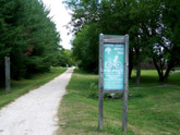
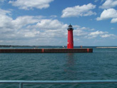
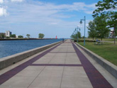
Here's the photo tour of the Kenosha County Trail from the Illinois/Wisconsin border, along Lake Michigan, on to the Pike Bike Trail, through Kenosha, and north to Carthage College. This ride was from July, 2010.
Kenosha County Trail Home < you are here
Kenosha Trail Photos 1 - Wis. Border to Lighthouses
Kenosha Trail Photos 2 - Lighthouses back to Port of Kenosha
Kenosha Trail Photos 3 - Wolfenbuttel Park back to Illinois
See the Root River and Racine Bike Trails article on this site for more information on this trail from Kenosha to Racine, Wisconsin.
- Bike Computers
- Bicycle GPS
- Bicycle Bags
- Bicycle Clothing
- Bicycle Lights
- Bicycle Locks
- Bike Parts
- Bikes
- Kids Bikes
- Exercise Bikes
- Bike Trainers
- Bicycle Car Racks
- Bicycle Hydration
- Bicycle Accessories
- Bike Blog
The KCT Photos1
The KCT Photos2
The KCT Photos3
- Algonquin Road Trail
- Busse Woods Trail
- Chain O'Lakes Trail
- Chicago Lakefront Trail
- Deer Grove Bike Path
- Des Plaines River Trail
- Evanston Lakefront
- Fox River Trail
- Great River Trail, Illinois
- Great Western Trail
- Green Bay Bike Trail
- Hennepin Canal Trail
- I&M Canal Bike Trail
- Illinois Prairie Path
- Illinois State Beach Bike Path
- Inverness Trail
- Jane Addams Trail
- Kankakee River Trail
- Long Prairie Trail
- Millennium Trail
- Moraine Hills Trails
- North Branch Trail
- North Shore Bike Path
- Old Plank Road Trail
- Palatine Trail
- Paul Douglas Trail
- Poplar Creek Trail
- Prairie Trail
- Prospect Heights Trail
- Randall Road Trail
- River Bend Trail
- Robert McClory Bike Path
- Silver Glen Trail
- Skokie Valley Trail
- Thorn Creek Trail
- Virgil Gilman Trail
- Wauponsee Glacial Trail
- 400 State Trail
- Ahnapee Bike Trail
- Badger State Trail
- BATS Crystal Lake Trail
- Cannonball Path
- Elroy Sparta Trail
- Great-River-Trail
- Kenosha Trail
- LaCrosse-River-Trail
- Military Ridge Trail
- Oak Leaf Trail
- Peninsula State Park Trail
- Red Cedar Trail
- Root River and Racine Trails
- Seven Waters Trail
- White River Trail


